Good evening,
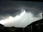
Right Now, Thunderstorms are have formed across SE Nebraska and Central/western Kansas. These storms are in a unstable airmass and will be producing large hail and some damaging winds. This line of storms will move ahead and along a cold front that will be moving into NE Kansas and NW Missouri later Tonight and stall out.
Thunderstorms will be moving through by daybreak Wednesday as weakened showers, Wednesday afternoon, Thunderstorms will be popping back up and bringing a chance of some damaging downburst winds. Heavy rain will also be possible.
Thursday Morning, The front will finally kick out and move through the area. Should be Sunny Thursday and Friday. Friday will be in the MID 70s. Which is perfect for anyone wanting to do any outdoor activity.
Zach "Weatherman" Kumke
Kumke Weather Services™
Weatherman Kumke
He's saving lives and Helping everyone know what its gonna be outside
Tuesday, August 31, 2010
Wednesday, August 25, 2010
Picture Perfect weather for the next few days
Good Morning,
A cold front moves through during the day on Tuesday leaving us with very beautiful weather over the next few days with highs in the low 80s and lows in the mid to lower 50s. It will be a great week before a heating trend continues into next week starting this weekend as temperatures warm from the upper 80s to the lower 90s.
There are no storm systems on the 7 day outlook. Just clear and beautiful weather.
Zach "Weatherman" Kumke
Kumke Weather Services™
Sunday, August 22, 2010
Waiting for Site Launch. Cold front and more.
Well. I'm waiting patiently for this to be set up and havign it launched by my marketer. I'm currently waiting for a big storm, however it doesn't look like any big systems are going to affect the area any time soon so we could be waiting for awhile.
This week. Should see highs in the low 90s Today and Monday before a Cold front swings through the area on Tuesday. Once that cold front moves through, Temperatures will be in the upper 70s to low 80s for highs the rest of the week and sunny. Wednesday Morning could reach the upper 40s for a low due to radational cooling. Right now going with 52. This weekend should see the return of the upper 80s low 90s as a High pressure system tries to move east and brings some more southernly winds along with it.
Going to try and update daily and bring everyone the best that I have to offer.
Zach "Weatherman" Kumke
Kumke Weather Services™
Saturday, August 21, 2010
The Launch of the KWS Blog
Good Afternoon,
I am Zach Kumke. A 17 year old weatherman out of Olathe, Kansas. I am using this blog to share weather information with others who already use my Facebook page and my Weather Alerts program to get information about the weather.
This blog is to help people understand all the things I have to look through before making a forecast and to also let others know what excatly I'm thinking about a storm system with links to model runs and pictures. Overall, it's to get an Inside look on a meteorologists job and how we do things.
This blog is just now getting under away so I will post more information and get more stuff done like addinga cool title, inputting sites, ect.
Zach "Weatherman" Kumke
Kumke Weather Services™
Subscribe to:
Posts (Atom)